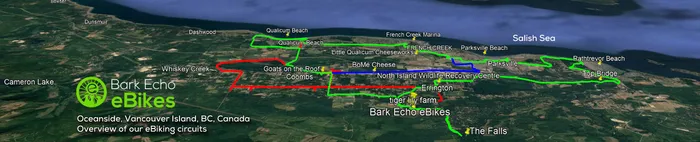
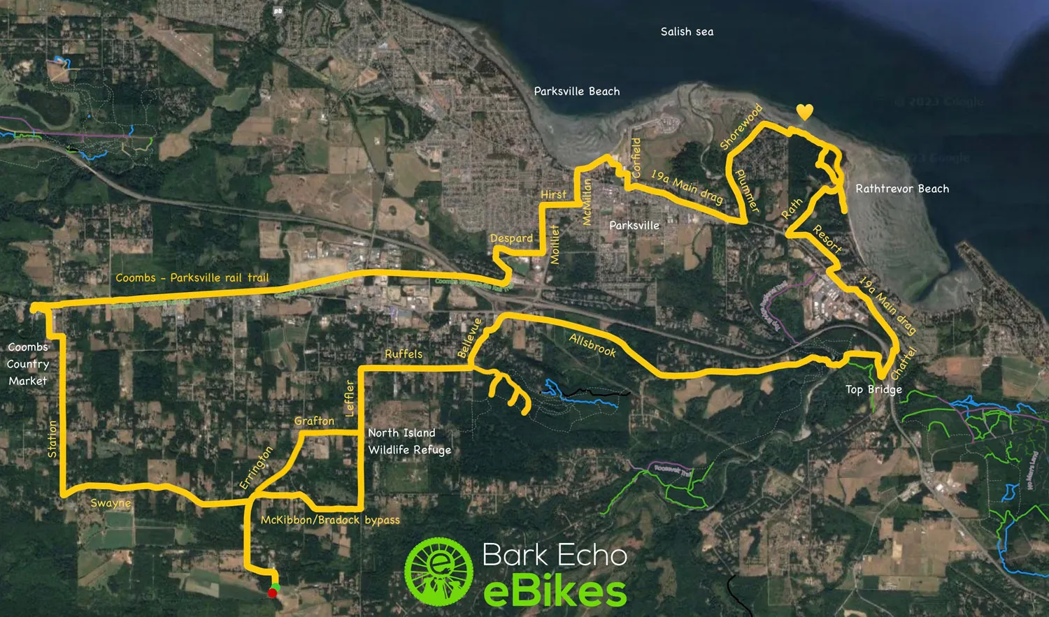
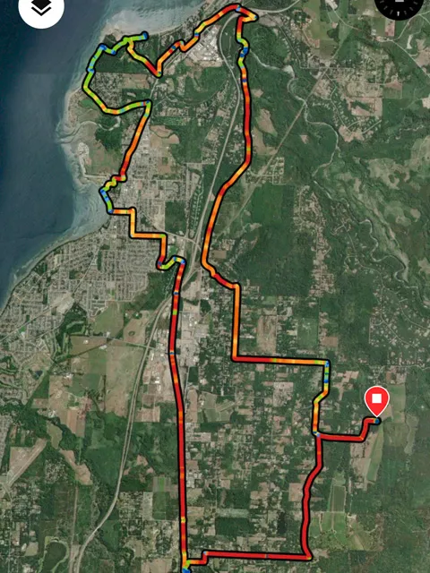
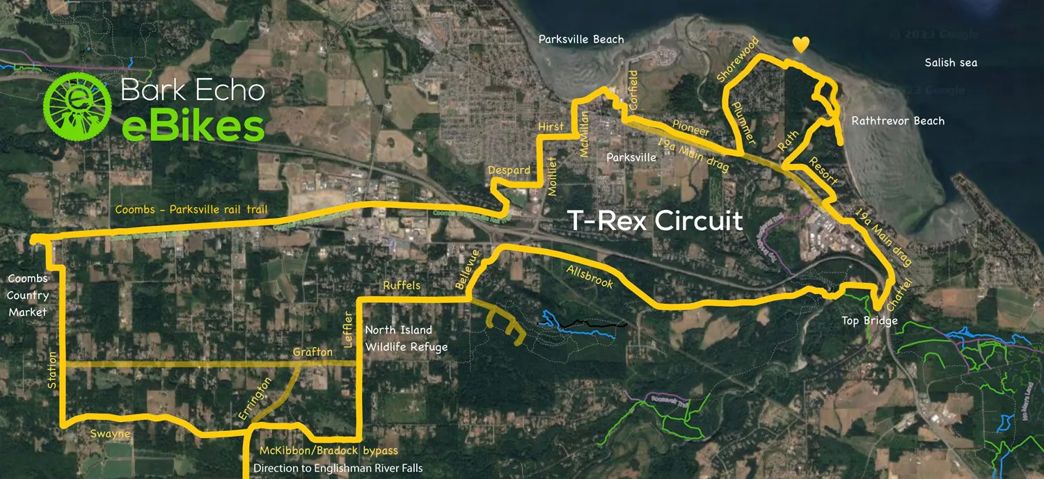
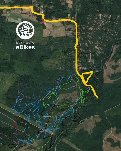
Originally I called this ride the Monster, because it went all over the place and covered everything. But it's not that long with an eBike! We mapped it out on our last ride at 44 Km. One of our newest team members pointed out that the circuit looked like a T-Rex! With a bit of imagination of course. If you have one single day to ride the area, this is the most comprehensive ride.

THE T-REX CIRCUIT : 44Km. 300 metre difference. About 5-6 hours with lots of photo stops! A full wonder-filled day.

This ride covers five of the major attractions in the Coombs/Parksville/Errington region.

  • Top Bridge Regional Park
  • Rathtrevor Beach and Campground
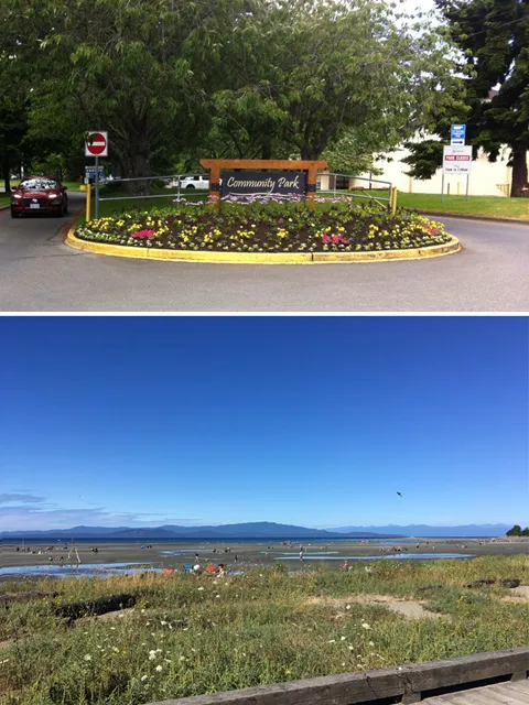
  • Parksville Beach and the boardwalk
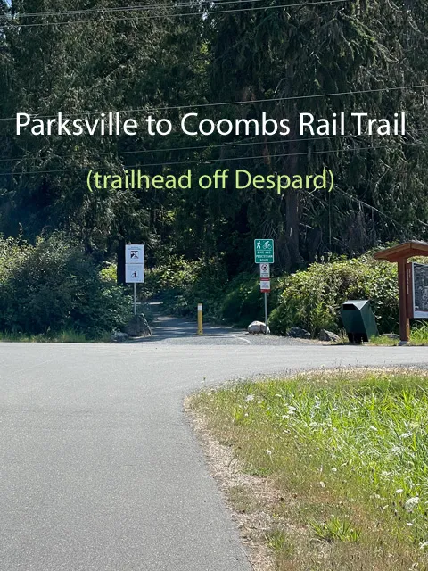
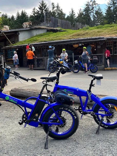
  • Old Country Market in Coombs with the goats on the roof, by way of the rail trail
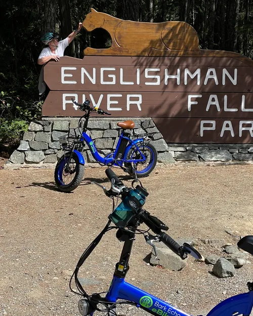
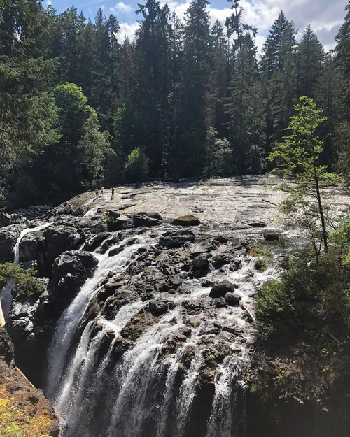
  • Englishman River Falls is that extra little bit if hard core riders want to extend their ride!

We strive to give you the best circuits to enjoy your ebiking rides, roads with slower traffic, less traffic, or none at all. You can pop onto the circuit at any point of course, depending on where you're at. And if you turn on your mapping apps, either your wrist devices or cellphone apps, you can draw your T-Rex, just like we did. 

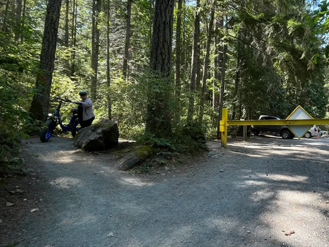
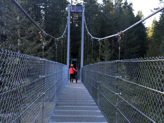
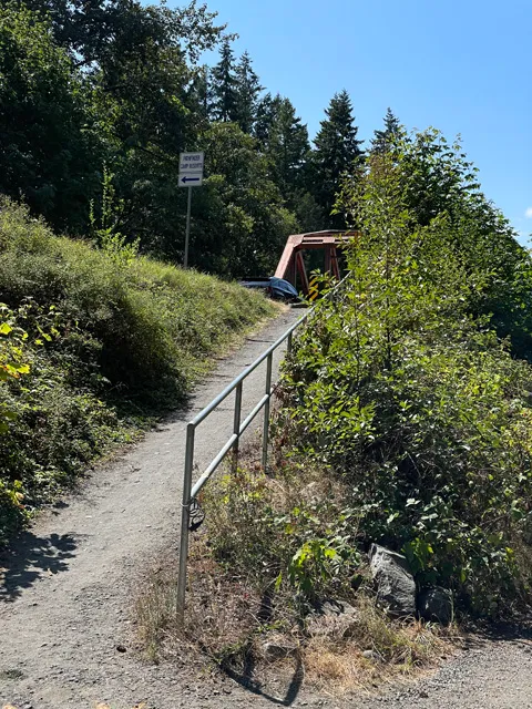
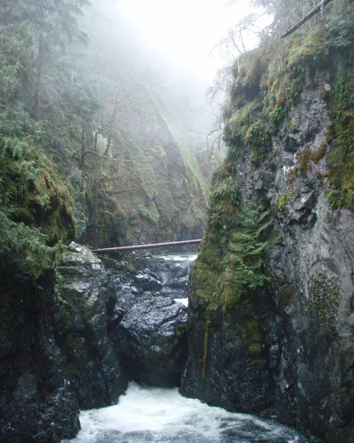
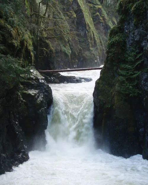
For this article, we are starting off at Bellevue road, right in the centre of the map, we rode mostly downhill along Allsbrook road, all the way to Top Bridge. It's a dead end, so traffic is limited. At the end of the paved road, there is a gate down to a parking lot, and another gate with a bike bypass on the right. A quick roll down the path gets you to the suspension bridge.

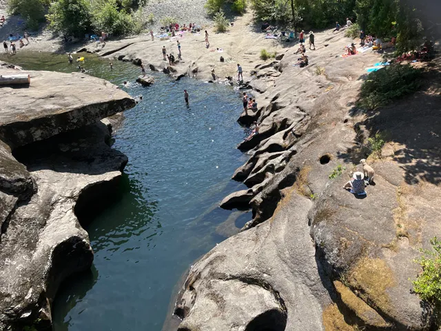
Lock your bike and click on the alarm if you want to go for a dip. Beautifully eroded stones to treat your eyes, and an arch on the downstream side.

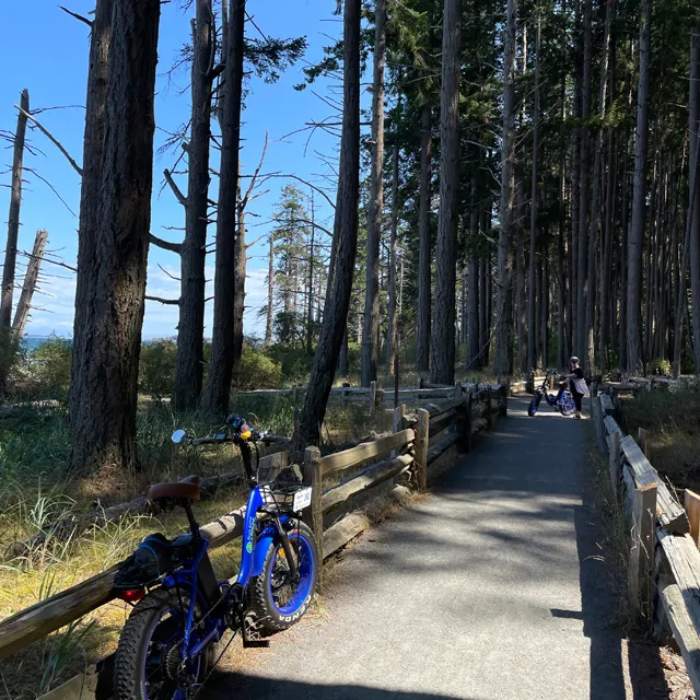
In and out of Top Bridge park, for a matter of a few hundred metres, is the only place you will encounter a dirt road.  (The Parksville to Coombs section or the Rathtrevor perimeter are pedestrian/bike paths with no traffic.)

Once  you exit the park, you have a serious climb out. But not painful at all with an eBike! This is Chattel road, it will take you up to the weigh stations beside the highway overpass. Under you go, after your left turn.

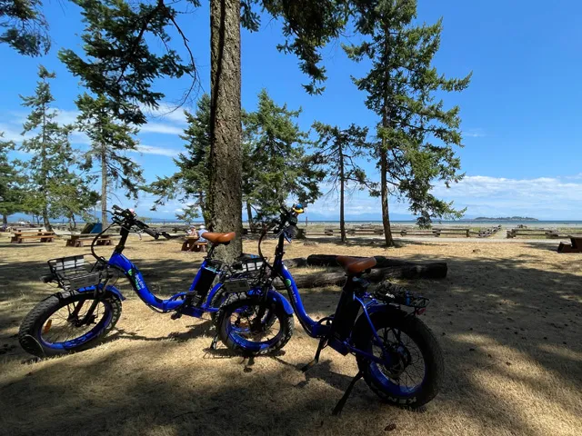
At this point, you can either stay on the 19a, Parksville's main drag, or use the side street, Resort way, for a short while anyhow. After this you'll see the park entrance sign, right and down the hill you go, into the park and right through the parking lot to access the beach. One of the nicest beaches on Vancouver Island.

After you marvel at that beach expanse, head up-island to the best bike and pedestrian path in the area. Photoshoot time!

Top Bridge park gate has a pedestrian/bike bypass. Watch out for those speed bumps on the way down the hill.

Swimming hole

Locals' hidden gem, that's one cool swimming hole. I guess, if you ride the circuit counter clockwise, you could end your day with a swim! Nice.

Winter or Summer ride

Winter or Summer, doesn't matter the season, it's always enjoyable to cross the bridge over the Englishman River

Save the T-Rex image to your photos app if you don't use any mapping apps (right-click, open image in new tab, then save). All the roads are labelled. Or, if you use Trailforks, find the Blue Buddha's ride log for a listing of all the circuits on our website. You can also create a free account to see Bark Echo's complete map of all circuits in the area. That way, you can zoom-in and out on the map and get as much detail as you need.

Rathtrevor Park and its big beautiful beach, you can hardly see the Salish sea at the horizon. Lock your bike and head out for a sunny stroll. Low tide can be quite a few hundred metres out, the shallow sand heats up the water very fast.

;-)

Major thumbs up for this section of the ride, the park's seaside path. My favourite photo spot for this circuit. See that tiny yellow heart on the map?

At the end of the Rath Path, there's a gate to the San Pareil neighbourhood. Take the right road, then turn left onto Shorewood, which turns into Plummer road. At one point you will see the dirt ramp up to what locals call the Orange bridge (IMHO, it needs a paint job!) Power off at the top, so you don't run into pedestrians while crossing the bridge.

Once across wander to Pioneer, the back road on your right. It ends at Corfield, which is the short hill down into Parksville's Community Park. A little wandering through will get you to the boardwalk. Best to power-off here too, it's level anyhow.

Dirt ramp up to the orange bridge, over the Englishman River and into Parksville.

Parksville Community Park gate to the boardwalk and beach

From the up-island end of the boardwalk, ride up the slope on McMillan and wiggle your way to Despard.

Same circuit, the T-Rex, a.k.a., the Chicken Run*, from a Garmin watch. I seem to recall hearing that chickens are a genetic descendant of T-Rex! LOL

Kulth-ka-choolth

Kulth-ka-choolth (Mount Arrowsmith), or jagged face in the local indigenous language, and of course, Bark Echo's signature rubber duckie,

Group of eBarkers at the goats on the roof

From the up-island end of the boardwalk (NW), ride up the slope on McMillan and wiggle your way through the neighbourhood to Despard, by way of Hirst and Moilliet. This is where the Parksville to Coombs Rail Trail starts, close to Springhood elementary School, 450 Despard avenue.

This section of the circuit follows the old Parksville to Alberni train track, but only the section up to Coombs. Level ride over compact gravel. Beautiful views of Mount Arrowsmith, or Kulth-ka-choolth by the local indigenous communities, meaning "jagged face".

Lots to explore at the Old Country Market. Shopping, restaurants, galleries and more across the bridge too.

After your perusing at the market, and required ebarker photo session with the goats on the roof, head down Island on the 4a's shoulder, but only as far as Station road on your right. Once you get to Grafton road you can either go left all the way to Lefler and Bellevue to close the circuit, or, straight ahead. This second option takes you to Swayne road,  a left turn leads you along a low traffic, scenic road that wanders all the way to Errington road.

From this spot you can either turn right and ride down to the Englishman River Falls, that's the fifth and last local attraction on this circuit. It's an in and out ride, the park's parking lot is the end of the road. This would add another easy and rewarding 10Km to your ride.

Englishman River Falls Provincial Park.
Yes, the Island has the densest population of cougars on this planet!

Quiet roads. As a bonus, to your right, if you happen to hang out with hard core mountain bikers, you can send them playing on those Hammerfest trails. Too hard on my bones and my bike!

This photo of the top falls shows tiny people far on the rocks. Not possible to do this in the winter as the volume of water is huge. We are after all in a temperate rainforest.

Map to the Englishman River Falls Provincial Park. That little blip of a triangle is around the campground. You can also see that massive spiderweb of Hammerfest trails. Our bikes are not built for this type of riding.

Englishman River lower falls, in the summertime, during drought season. A massive  rock blocks the flow. A trails goes down to these lower falls and comes back up the other side.

The lower falls in the wintertime. The massive rock blockage is completely covered. 

The short option is to turn left onto Errington road, make your way back up to Grafton road and turn right onto it, to get you back to Lefler. Or, you can bypass Errington town centre by way of the McKibbon/Braddock gravel road and path (a very short distance on your right), back to the bottom end of Lefler. Left and up the hill back to Ruffels and then Bellevue.

Wow, that's some ride!

* Are Chickens Really The Closest Descendants Of T-Rex? YES! So theoretically, the T-Rex circuit can also be called The Chicken Run.  ;-)

Cheers!

The Extended Bark Echo eBikes Team!